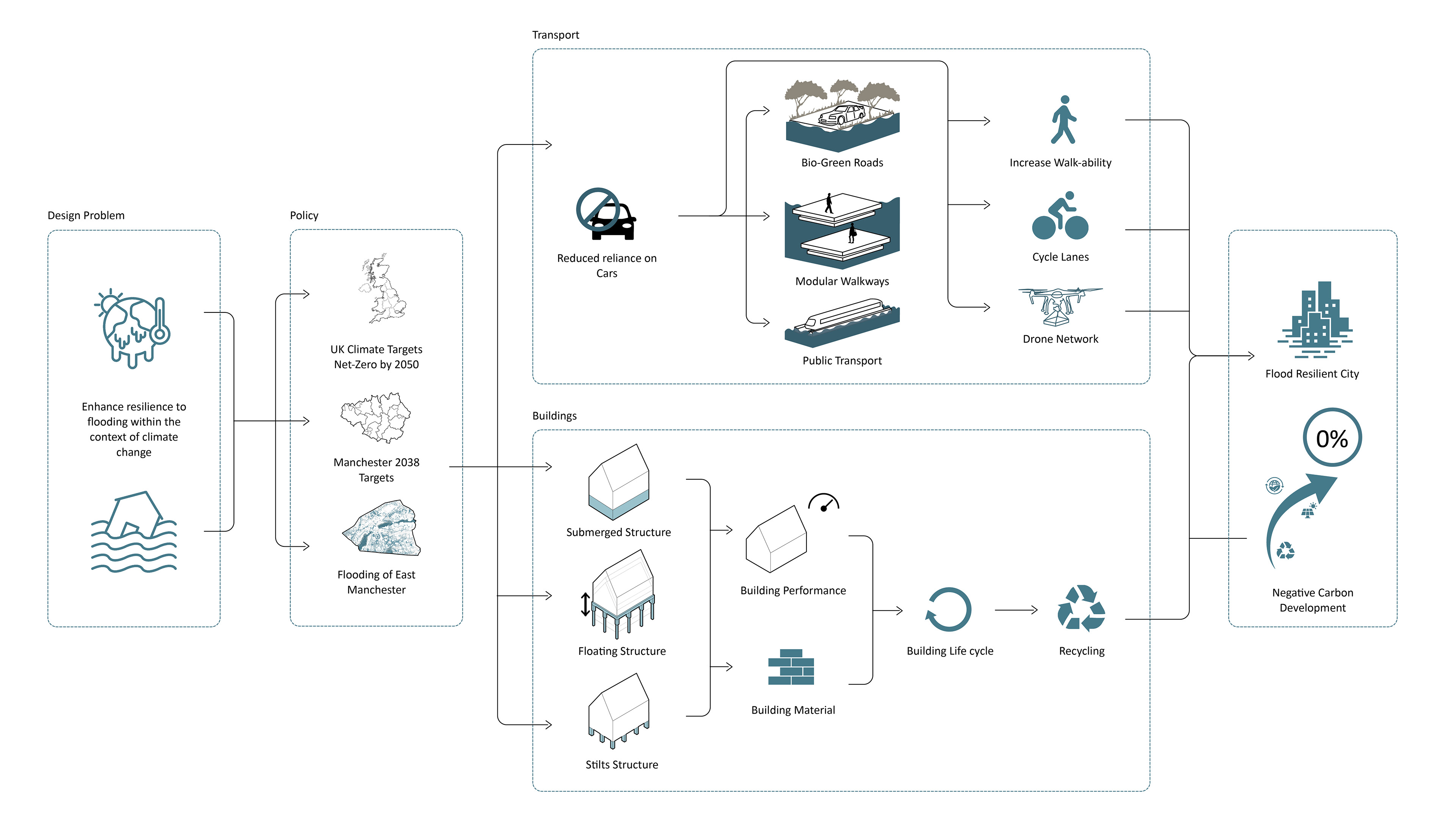
In 2050, climate change has passed its tipping point, intensifying extreme weather and causing frequent urban flooding. Manchester is one of the cities most affected.
This thesis project reimagines East Manchester as a flood-resilient city, confronting the threats of climate-induced flooding and rapid urbanisation. Rather than viewing water as an adversary, the proposal embraces it as a dynamic force that can shape and enrich the urban environment. The design integrates architecture and landscape to create a multi-layered, adaptive fabric that can absorb, redirect, and live with water.
The design employs a hybrid approach, combining hard and soft systems. Elevated buildings, permeable landscapes, and adaptive thresholds allow the city to respond to flood events. Streets, parks, and public spaces are reconfigured to serve as water storage areas while remaining safe and accessible. Rooted in resilience theory, the project rejects static solutions and instead values regeneration, learning, and adaptability.
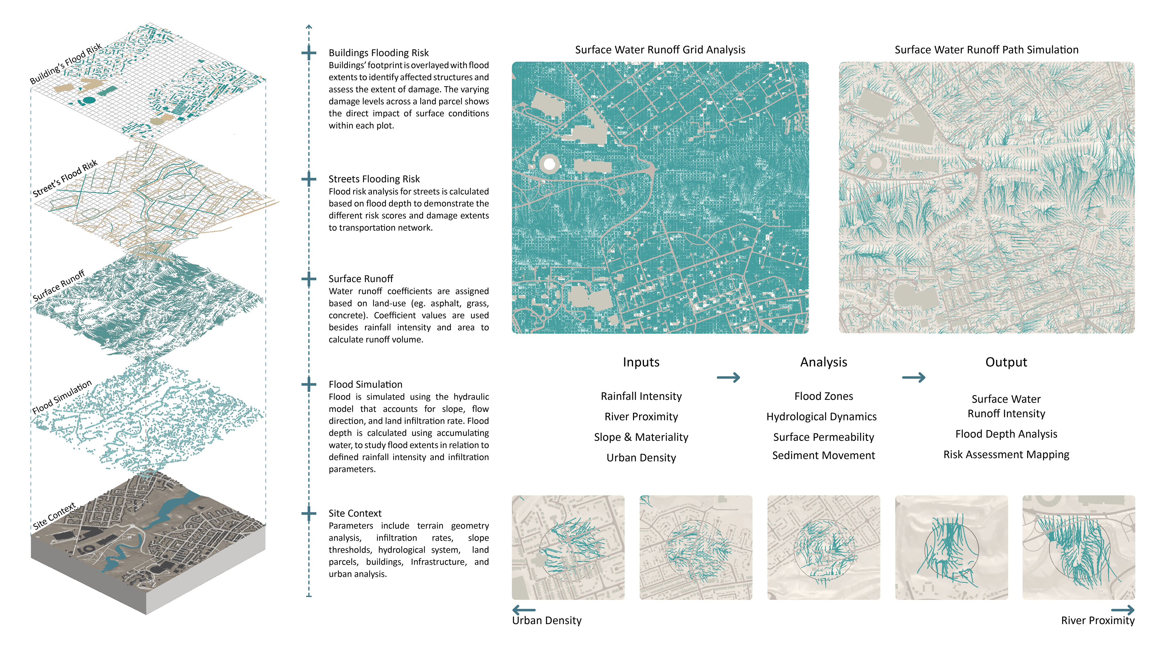
Community needs guide each intervention, aiming to reduce disruption and enhance everyday life. Real-world flood modelling, simulations, and spatial data inform a responsive planning strategy. Circulation networks are designed to function during floods, and public spaces prioritise environmental performance and inclusivity.
Through this integrated approach, the thesis presents a vision of East Manchester that does not simply survive flooding but evolves with it, offering a blueprint for future cities that are resilient, connected, inclusive, and attuned to the rhythms of water.
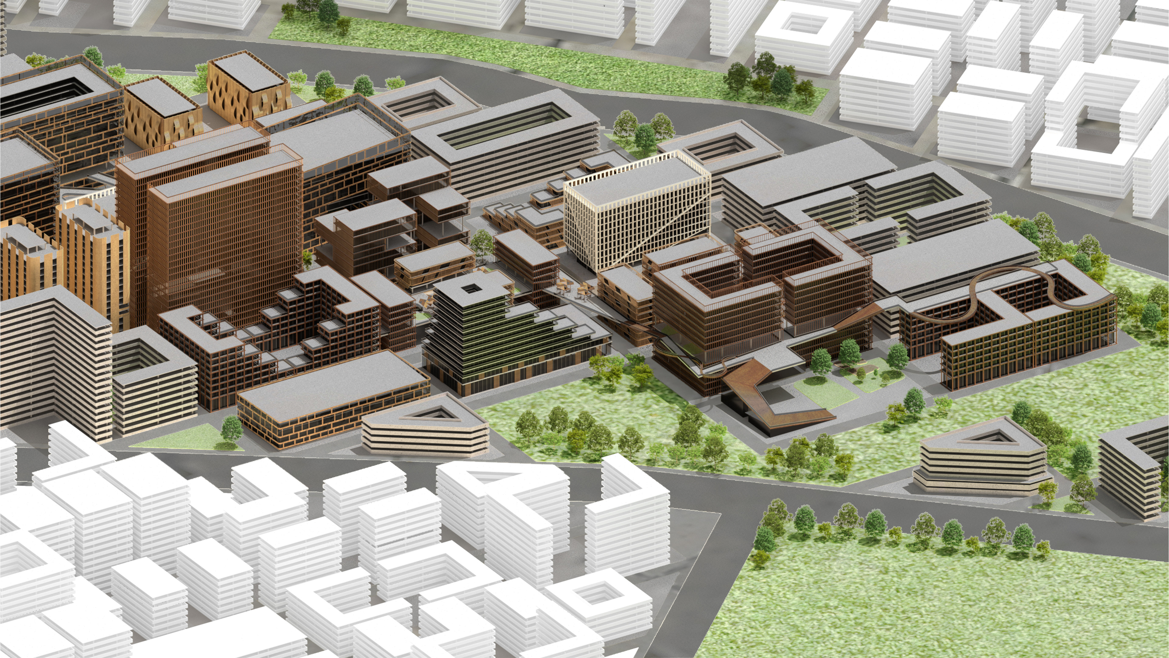
The goal is to create a development designed for flood-prone areas that embraces flooding and adapts to it without halting functionality by using different typologies. East Manchester would integrate with the water, continuing to operate seamlessly while adapting to its presence.
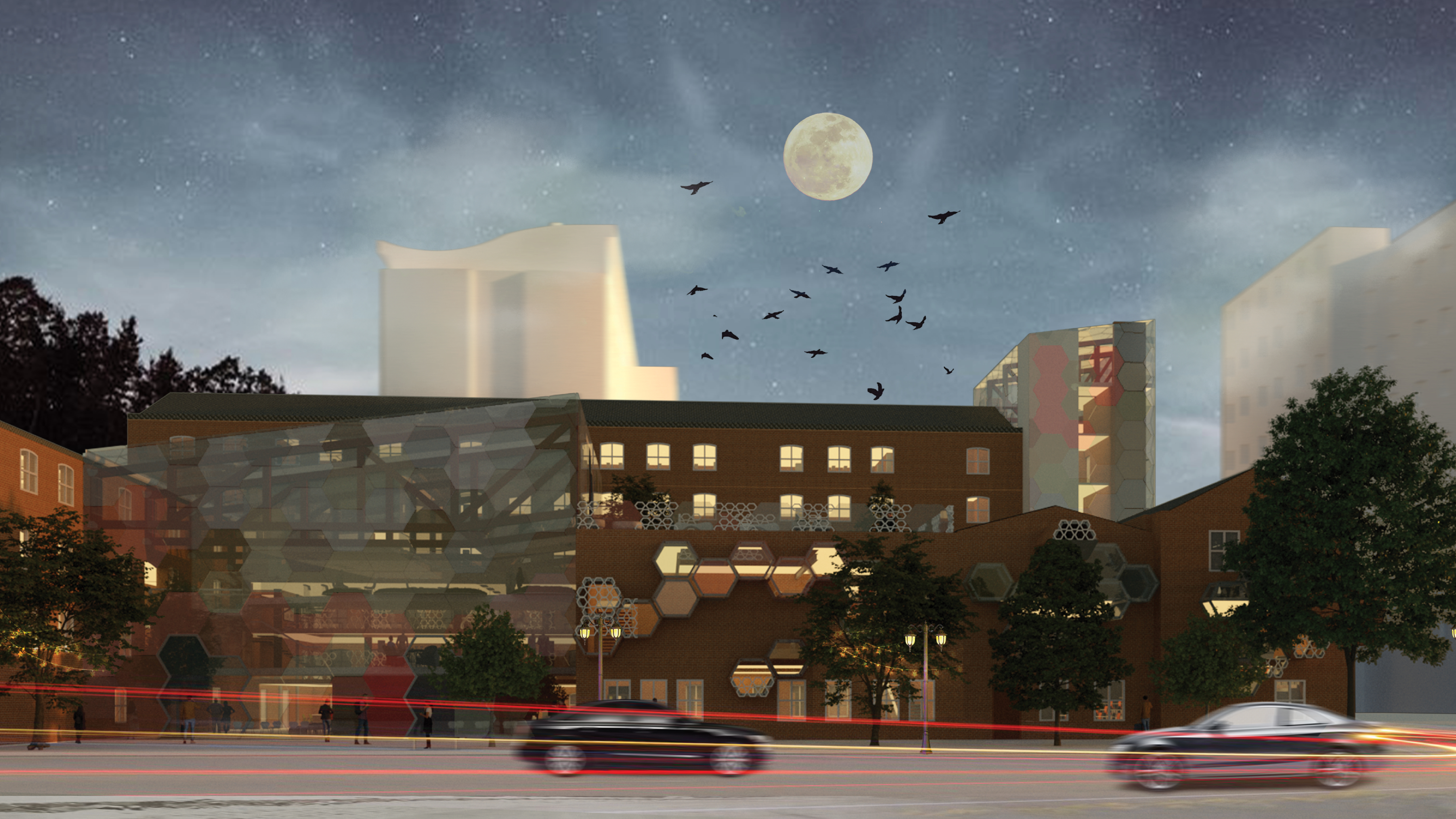
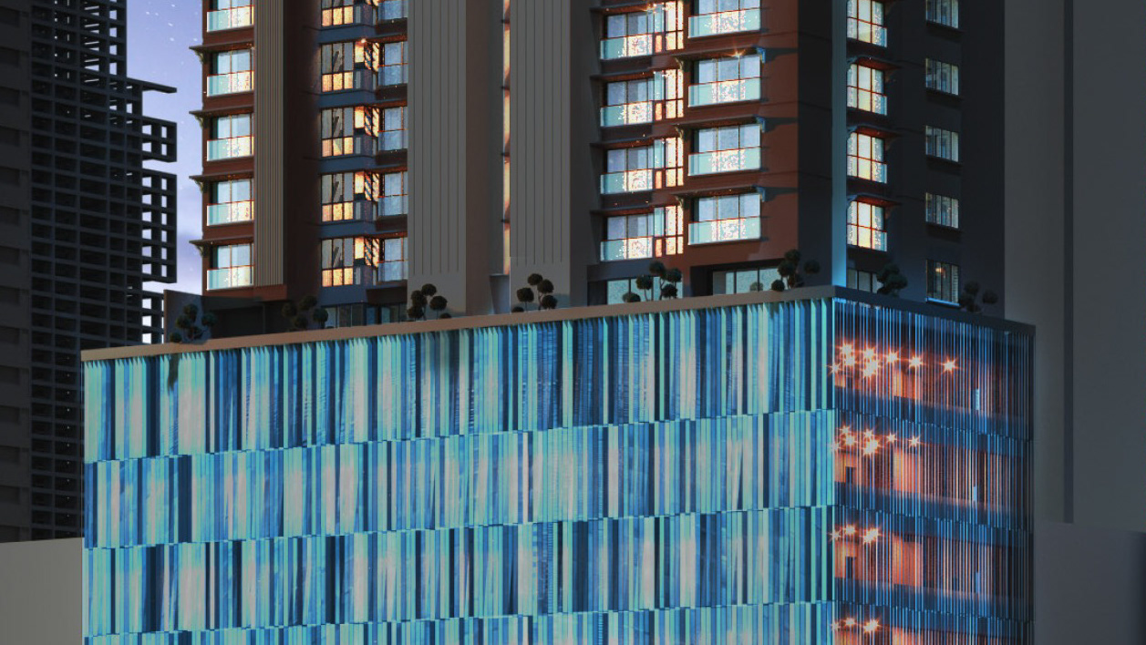
The flood-resilient city includes diverse building typologies of residential, commercial, and mixed-use across low, mid, and high-rise forms. A flood-adaptive landscape and a network of dispersed pathways ensure safe movement throughout the site. These design strategies enhance accessibility, social interaction, and overall liveability.
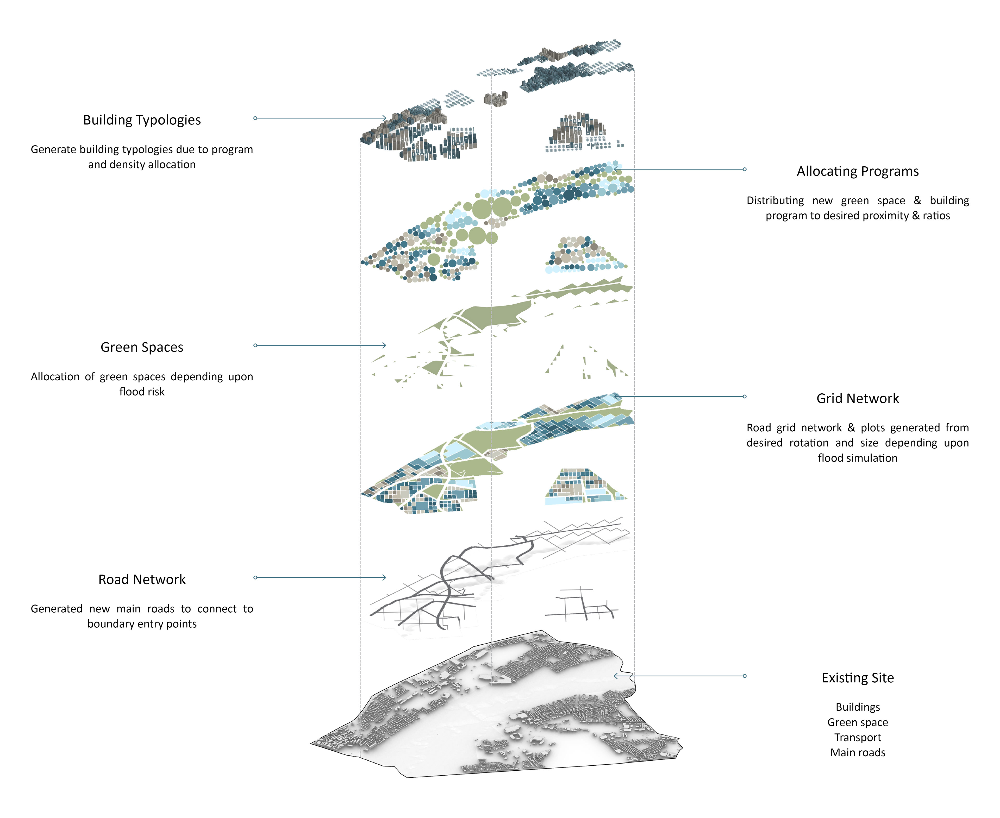
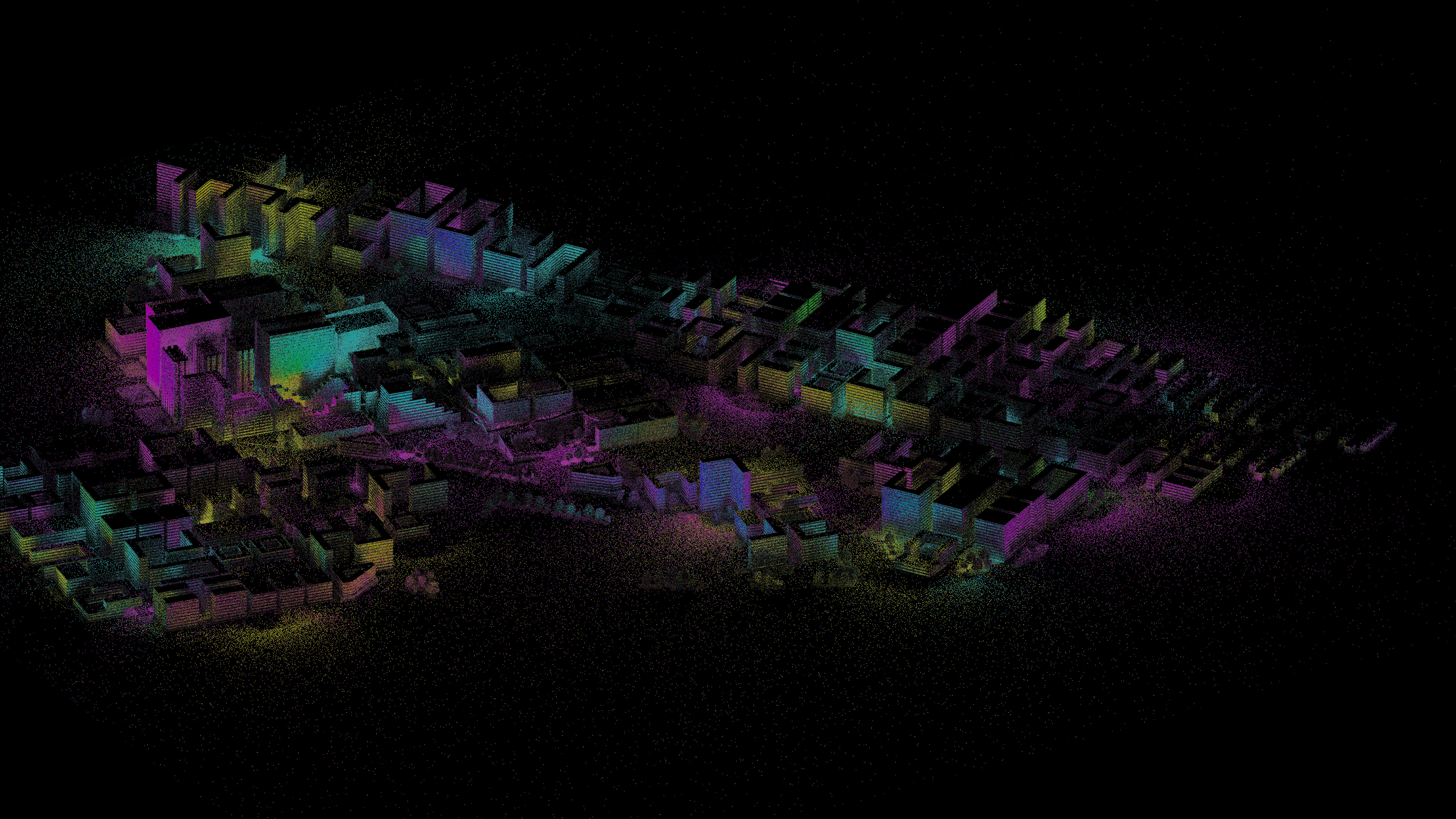
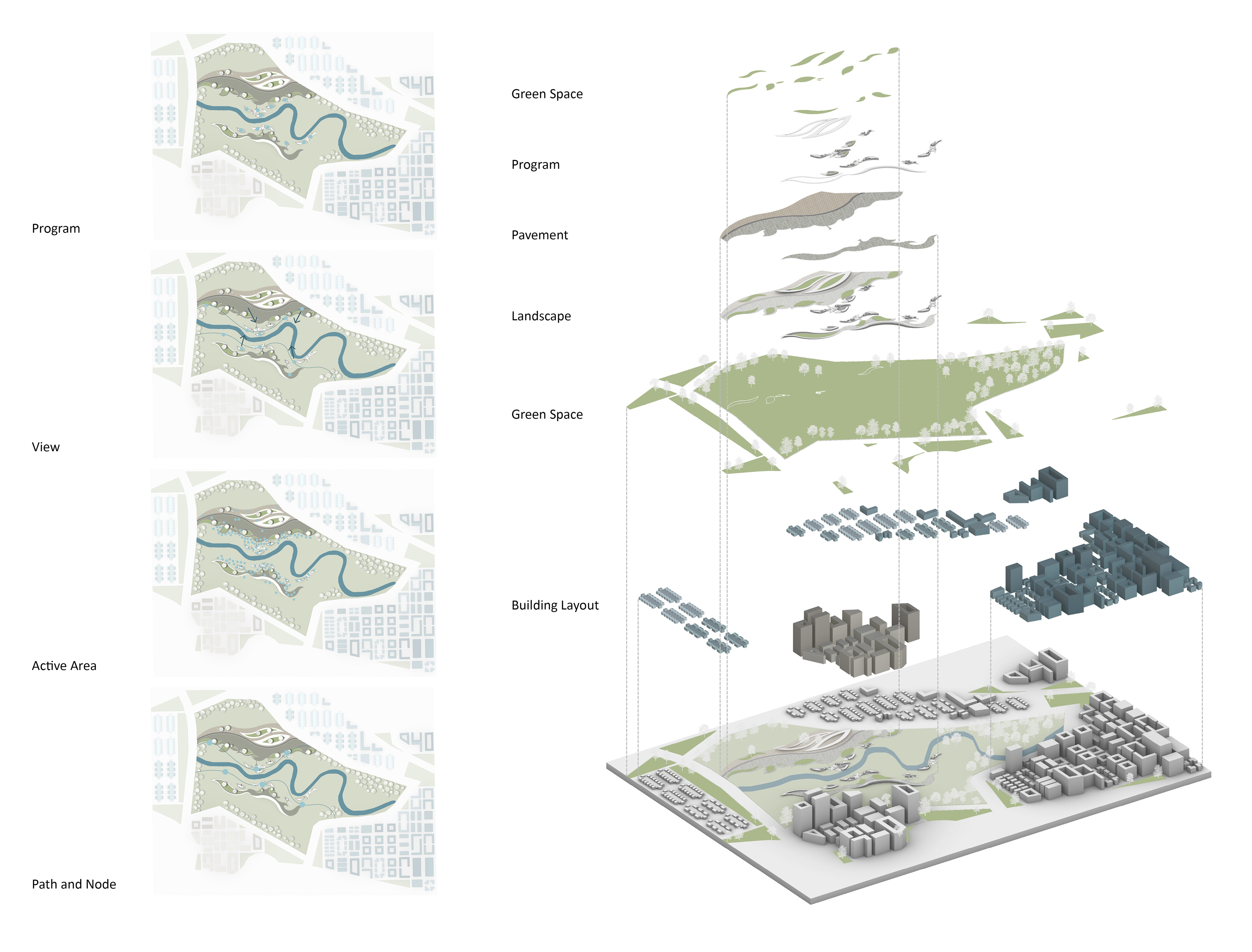
This visual spread maps the spatial layers of the selected iteration, illustrating the transformation from the existing built fabric to proposed interventions, including new green spaces, road and grid networks, building typologies, and programme distribution.
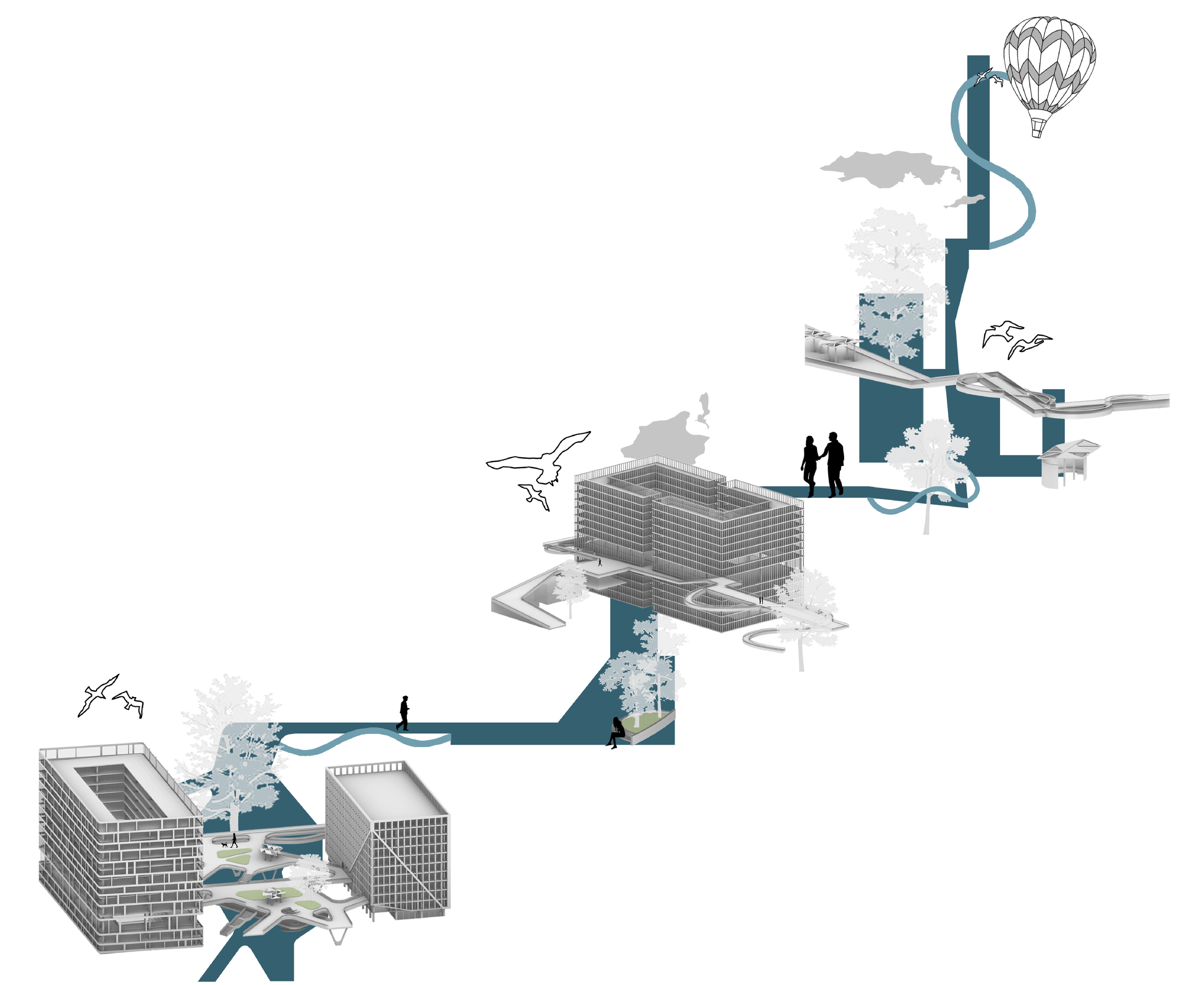
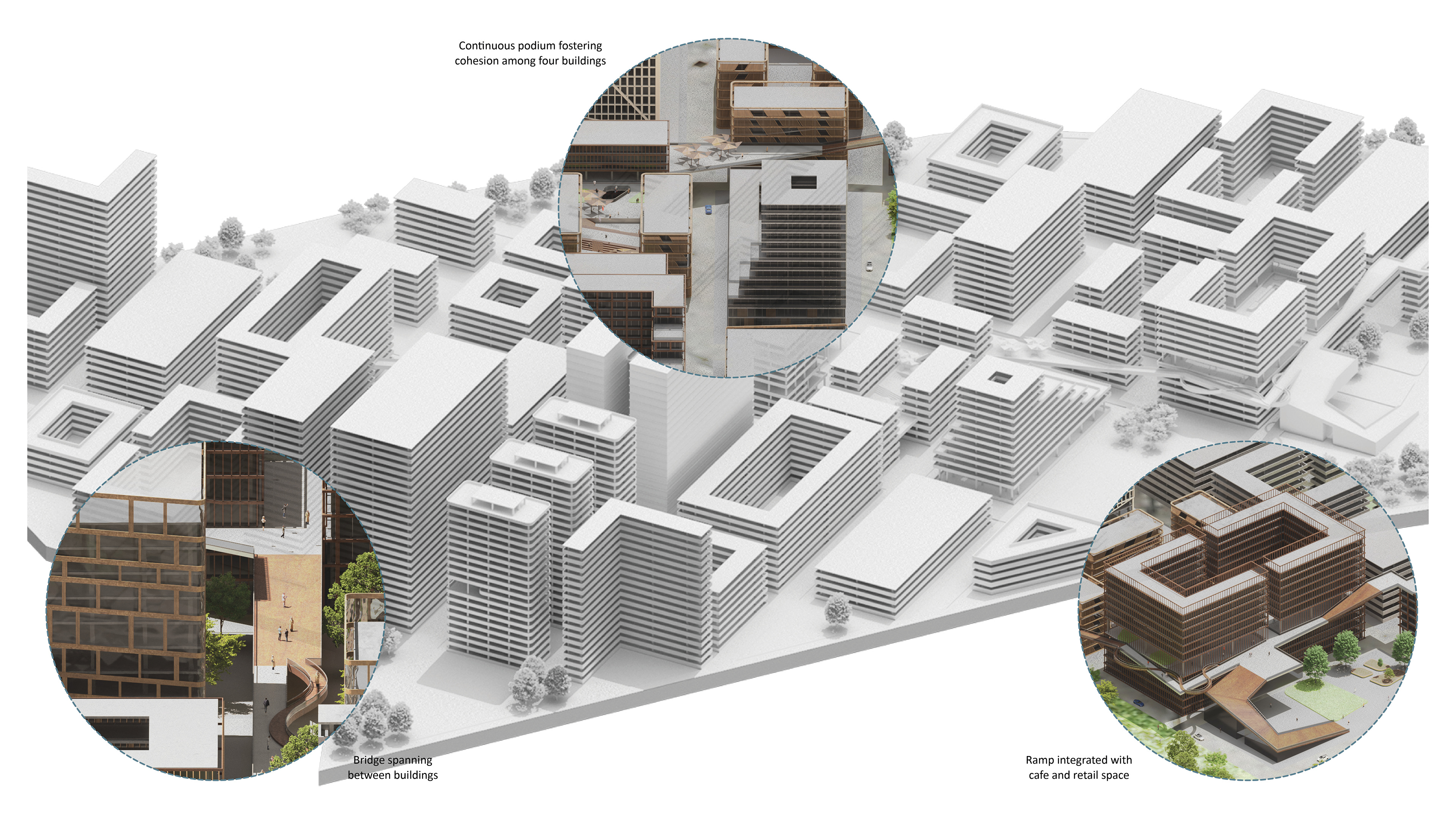
The pathway system extends comprehensively across the entire site, establishing critical connections between key functional zones through a series of bridges, plazas, podiums, ramps, and terraces. Designed with flood resilience as a fundamental principle, the pathway not only facilitates circulation during normal conditions but also plays a vital role in flood events by maintaining accessibility and supporting community interaction. Its elevated and permeable elements allow flood waters to pass beneath or through without obstruction, thereby reducing surface water accumulation and mitigating flood impact. Strategically located within identified flood-prone areas, the pathway contributes to the overall resilience of the site by promoting social cohesion, ensuring safe egress routes, and enhancing liveability even during adverse flooding conditions.
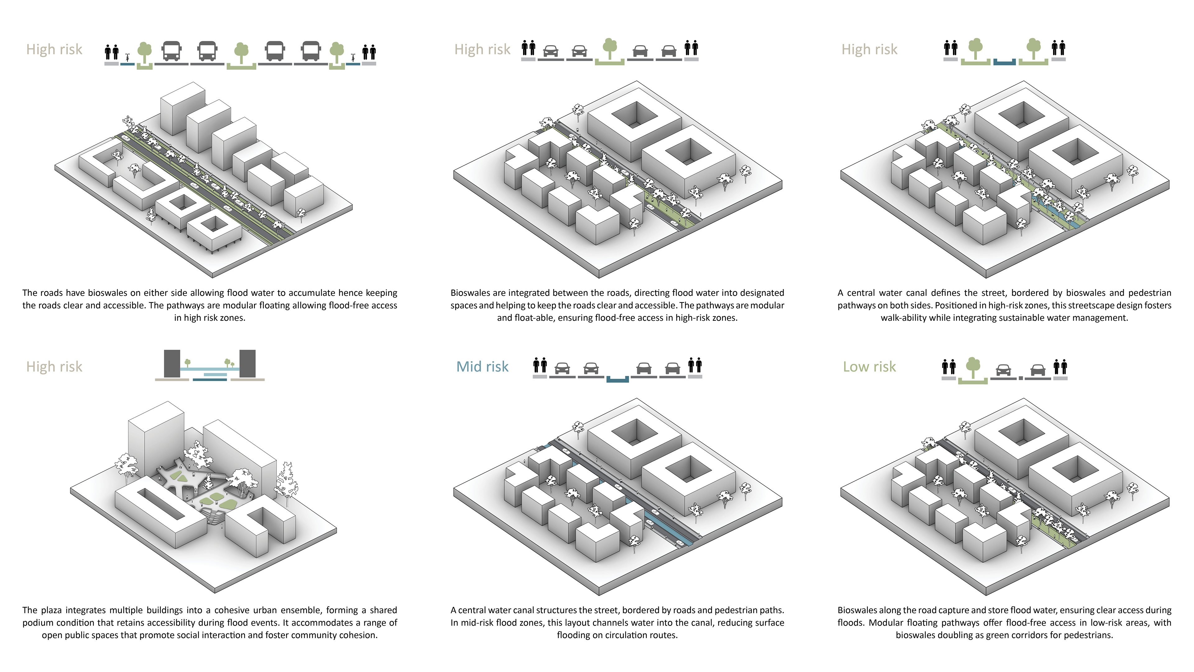
Primary streets are widened to support multifunctional public spaces and integrate flood resilience through bioswales and modular pedestrian routes, promoting accessibility and liveability. Secondary, narrower streets respond to high, medium, and low flood-risk zones, with strategically designed roadways enhancing adaptability. This layered street network balances functionality with resilience across the urban fabric.
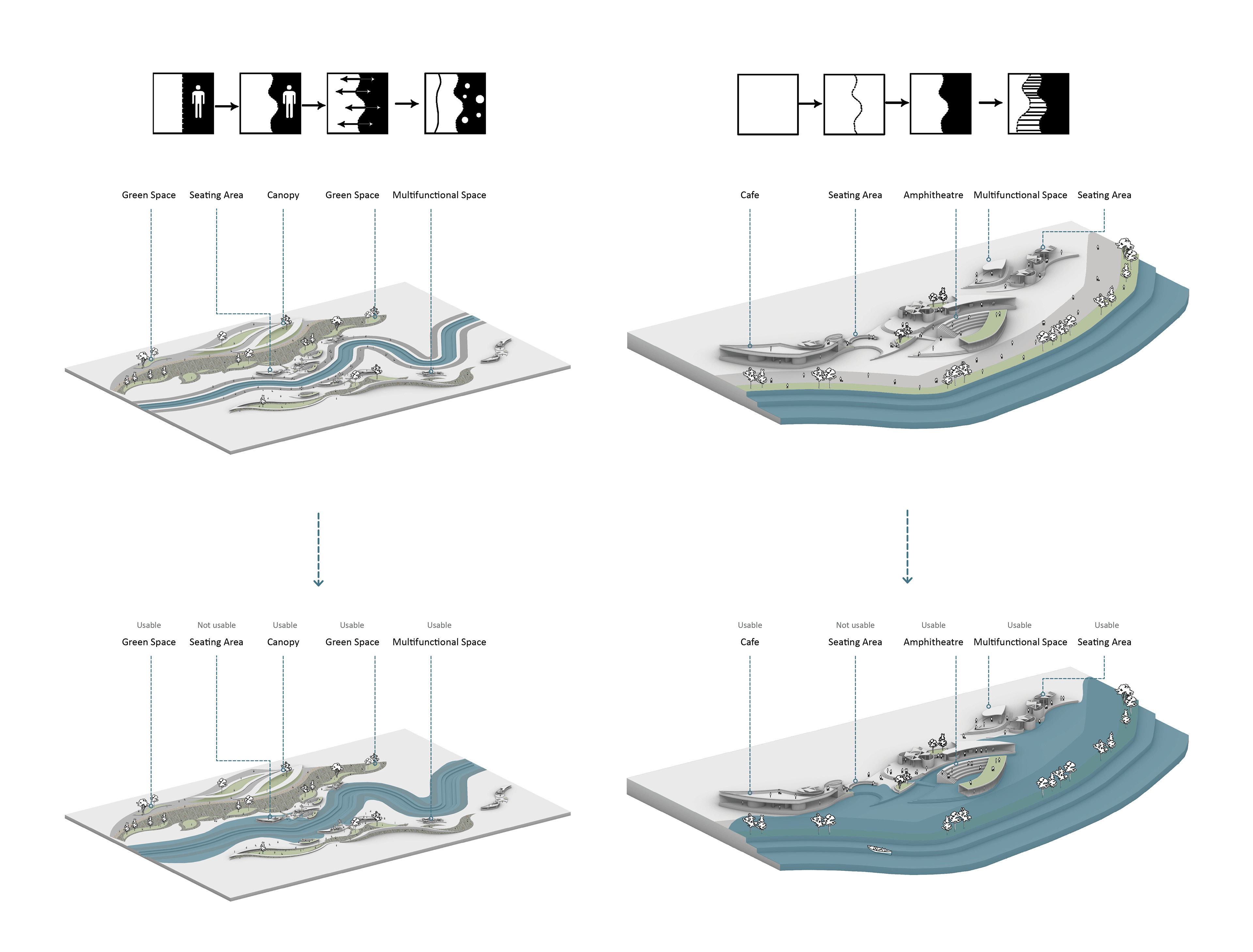
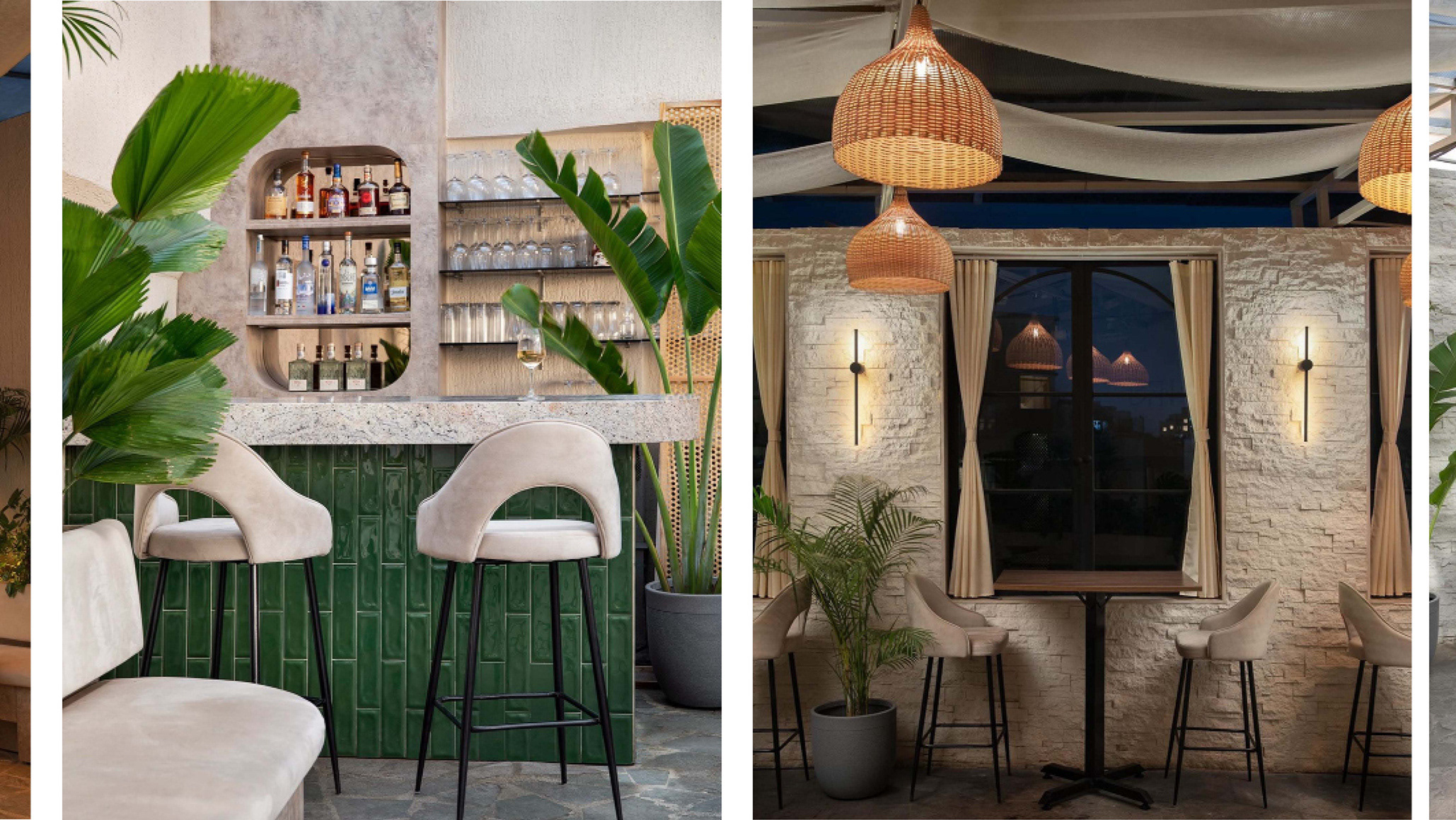
The landscape design features a variety of public spaces including cafes, reading areas, seating zones, amphitheatres, and multifunctional spaces which are arranged across multiple levels. This ensures that upper areas remain accessible during flooding when lower zones are inundated. The design incorporates diverse vegetation, including flowering plants and trees, to support biodiversity. A continuous pedestrian promenade along the river front provides uninterrupted access and scenic views. Flood resilience is achieved through elevated public spaces, water-absorptive planting, and an elevated riverside path that maintains safe access and connectivity during flood events.
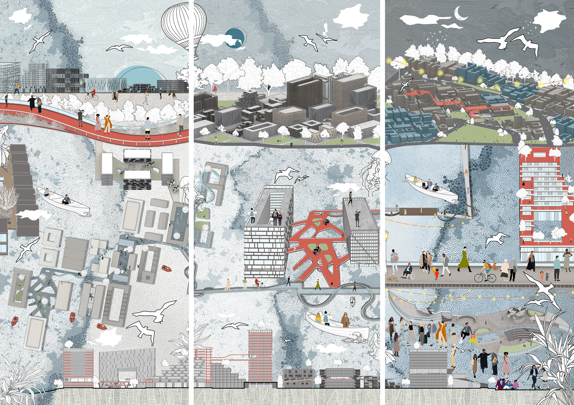
The illustration presents three collages of the site during morning, afternoon, and night, depicting the flood-resilient city in an expressive and illustrative manner. It provides a detailed exploration of the urban fabric’s plan and design elements, with a particular emphasis on the landscape and pathway configurations. The composition thoroughly conveys the spatial organization and the integration of flood resilience strategies within the urban environment.
This thesis has explored how architecture can respond to the complexities of future flooding through a systems-thinking approach rooted in environmental resilience and community continuity. By simulating dynamic flood scenarios and testing iterative design responses, the project demonstrates how adaptive urban forms can minimise disruption and empower residents to coexist with water. The integration of an interactive medium reinforces the importance of accessible, experiential design communication in shaping spatial awareness. Ultimately, the proposal envisions a flood-resilient East Manchester, not as a site of retreat, but as a model of anticipatory urban living shaped by ecological intelligence and social equity.